Nearmap MapBrowser makes it easy to export high-resolution aerial imagery for use in property management, land assessment or GIS software. This guide will get you up and running with 2D Export, whether you need a single image or a large area export.
What is 2D Export?
2D Export lets you download Nearmap’s vertical imagery from MapBrowser for offline use. You can:
Note: Exporting imagery uses area-based credits from your Nearmap subscription. If you cancel an export while it’s processing, the credits will still be deducted.
Single image export
This is perfect for quick snapshots of your area of interest.
- Navigate to your desired location in MapBrowser.
- Click Export, Single Image.
- Set the scale, resolution, and format (JPEG or PNG).
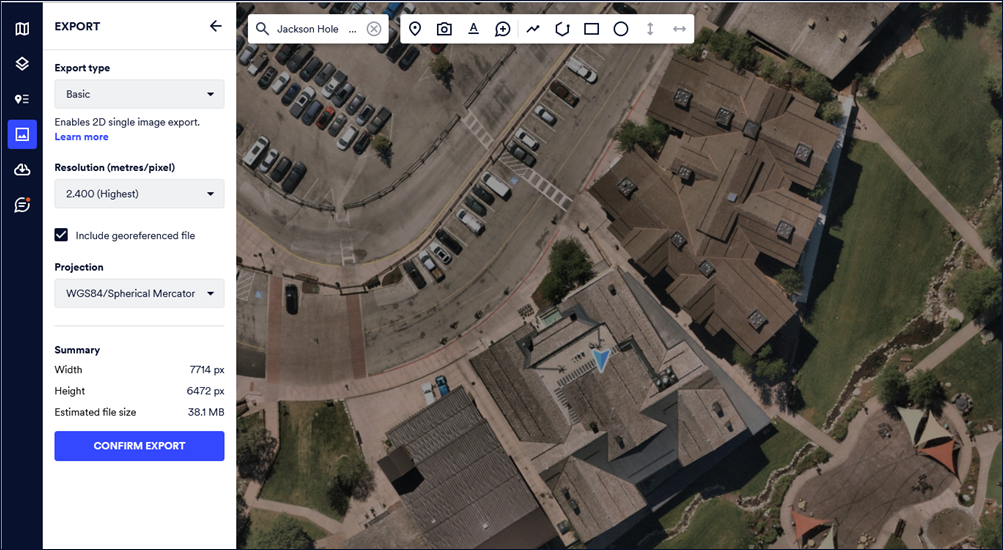
- Download and save your image.
For complete instructions, see Basic 2D Single Image Export.
Large Area Export (Tiled)
For GIS-ready imagery and larger projects:
- Select Export, Tiled Export.
- Choose your file type: GeoTIFF, JPEG, or JPEG2000.
- Define the export area and projection.
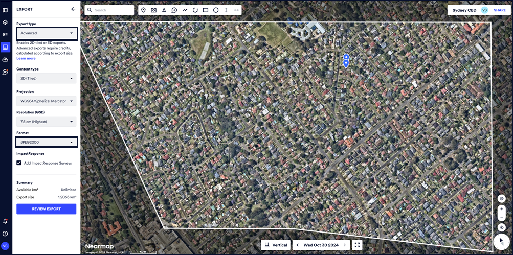
- Start the export, then download the files when complete.
Downloading Your Exports
Once your export is ready, you can download any number of time within a 60-day period from the date of export.
For details, see Download Content