Low Resolution Downloads

Hi
When trying to download a high quality aerial image, the download comes through as low quality, no matter what I choose. I even found a higher resolution image for free on another website.
Further to that, I tried to find how to contact someone for help, but your ticket logging seems broken.
Please advise.
Comments
-
Hi @Marco_31739,
Good day to you. I'm sorry to hear that you are having issues with logging a ticket with us. I will raise a support ticket and reach out to you directly.
-
Hi @Marco_31739,
Thanks for reaching out.
I can see that Roy has setup a ticket for you. Ill still provide a public response here however.
I have checked the Support form on the Nearmap website and it looks correct and functional for myself. You can also raise support tickets via our MyAccount portal, if you have trouble in the future. Would you be able to comment if you are still having trouble with the website form?
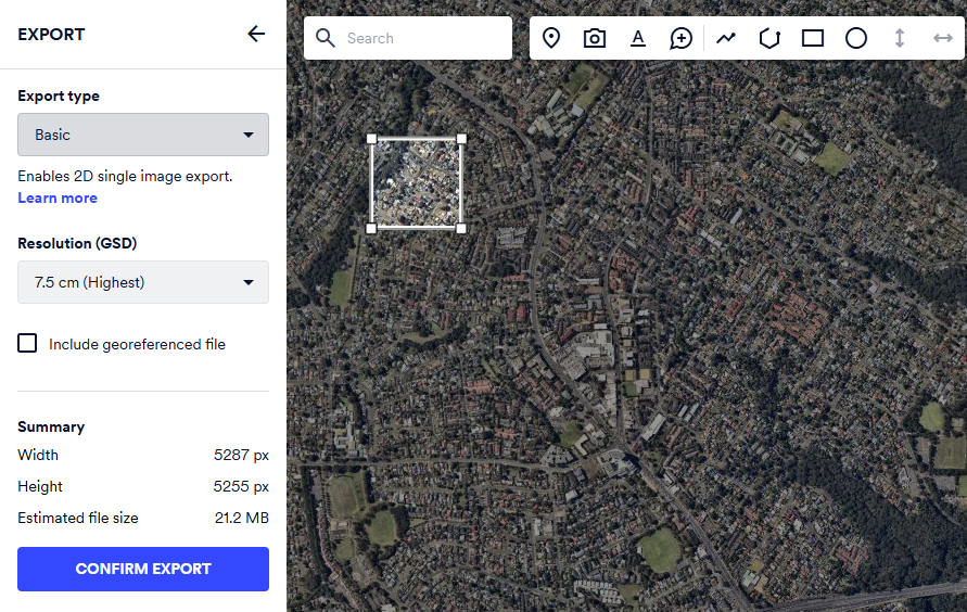
Regarding your imagery export. There are two types of export subscriptions. Basic Export and Advanced Export.
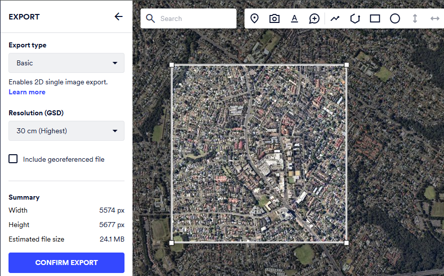
Basic export is available, naturally, for most customers. You will notice though that the highest GSD available will change based on the size of your export area. For example:
GSD = 7.5cm
GSD = 30cm.
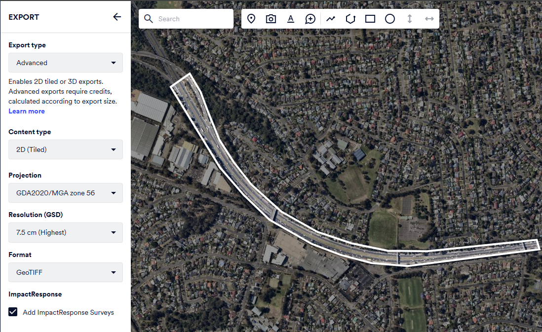
Advanced export however allows you to draw your own AOI. This can also be be irregular shaped, like my export here following the road. You can also export larger areas at higher GSD. Advanced export does however require that you have an export limit. 3D and Advanced 2D exports are charged against your usage limit.
If you want to import larger images into QGIS you can do one of the following options:
- Export a lot of smaller AOI georeferenced using Basic export.
- Use, or investigate adding to your subscription, Advanced export.
- Connect our Tile or WMS service to QGIS directly.
If you choose to integrate our APIs directly into QGIS then please keep in mind that our APIs could charge additional usage. This comes down to how the applications request content which can generate more usage. Please let me know if you have any questions, or are interested, and I can go into more detail. WMS, for example, is really easy to consume a lot of usage quickly.
Quick tips for using our APIs:
- Does the projection, or Datum, matter to you?
- It looks like you are overlaying other layers over the top of our imagery and that you pulled our imagery in EPSG2193. This means the Tile API, which is most usage cost effective, would not be appropriate.
- The Tile API is only able to be used in Web Mercator at the date of capture.
- This means you have to use WMS. You can find instructions for integrating WMS here.
- It looks like you are overlaying other layers over the top of our imagery and that you pulled our imagery in EPSG2193. This means the Tile API, which is most usage cost effective, would not be appropriate.
I hope that this helps.
Please let me know if you have any questions.


