Is there a view where I can see the name of each of my location markers without hovering over them??

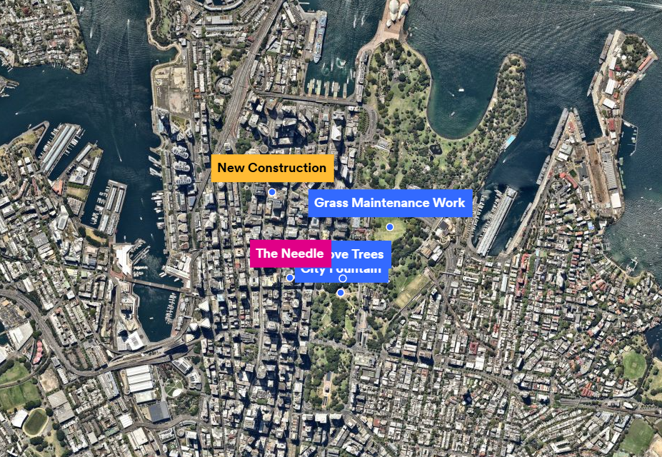
I'm trying to work out the best option for showing different locations on a map. I was adding text to a location but, when I zoom out, it's very hard to see where it's pointing to. So, I thought I'd try location markers but I'm not sure how to show the name of the location without hovering over as I've done in the screenshot. I've also included a screenshot of the overall area I'm wanting to show.


Any thoughts would be appreciated.
Answers
-
Hi @Emily_33391,
Thanks for reaching out.
Unfortunately I don't have a really solid solution here for you to solve your problem. I have two recommendations to consider however.
- Lower the text field font size.
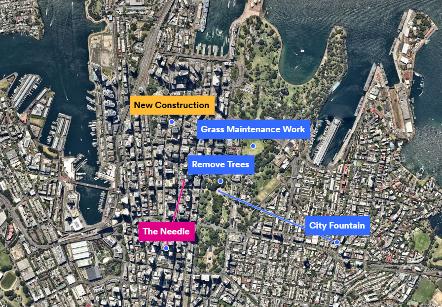
You might be to lower the font size to the point that all the text fields are visible on screen. The font size is a static value. So if its set really high the text field will grow bigger with it the further out you zoom. Based on your printscreen I don't think this will solve your issue though. It might help you with smaller clusters of text fields though. - Manually connect the text fields from outside the overlap zone.
Another potential solution is you could look at manually moving your text fields and connecting them to the point of interest manually. Its not the most ideal solution, and might be quite manual depending on the number of text fields, but it would allow you to display multiple text fields and clearly understand the information you are sharing. For example:
If you would like to use this process I would recommend considering the following tips:
- I would place the text fields at the locations of your interest, see that they overlap, then create a new text field outside the view (At the zoom level you want to snapshot it). Then draw the line connecting them. Then delete or hide the original text field.
- If you want the line to have the circle point to indicate the starting point then use the Radius tool. You can also turn the opacity down so its represented as a proper dot.
- The order of how things are displayed on the map is determined by the order of the object in the layer manager. So if you want the line to be displayed under the text box (eg. City Fountain Line) then place the text field above the line.
At the end of the day though I think we need to investigate solving that problem for you with better textbox management at different zoom levels. I would love to provide some feedback on your behalf to our MapBrowser product and design team. Would you be able to share some more information so we can better understanding on how we should solve this problem?
- What sort of work / project are you trying to visualize?
- Are you trying to export this information out with a snapshot to present to others? Or is this for your own visualization?
- Do the different colour's have meaning in your project? Could this information be grouped together in some way?
Unfortunately I can't guarantee that we will be able to investigate making this improvement, or if we can when this might happen, but Ill certainly raise this with the team on your behalf.
I hope though that my workarounds might help you.
Kind regards,
Brendan - Lower the text field font size.

